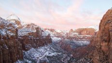
As one of the most iconic hikes in the entire United States, the Narrows in Zion National Park is a fantastic adventure that should be near the top of any hikers list. The 16 mile top-down backpacking trip gets more and more beautiful at every turn, and walking through the water the entire time is so unique that you can’t help but enjoy it, especially in the heat of summer. It is not as easy as it sounds, but if you take your time, most people in decent shape should be able to check this hike off their list. Here are all the details in one massive post that should help you to prepare for this hike if you choose to do it, make sure to leave any questions you have in the comments and watch the video at the end.
Details
- Need to get a permit in advance
- Need to book a shuttle to get to the trailhead. We used Zion Adventure Company, and they were great
Pack This (+ all of the other backpacking items you need)
- Waterproof phone case
- Waterproof map
- Water filtration device
- Dinner and Breakfast
- Hiking Poles
- Rent neoprene socks and shoes from Zion Adventure Company
Video
I would recommend securing a campsite or hotel in Zion for the night before you leave. This will help you to prepare for what you are about to do and will cut off any commute to get to the shuttle.
We camped the night before in Watchman Campground, and it was a nice walk up spot that was somehow secluded yet close to everything. There was a store for food and drinks, easy access to the Zion shuttle, and plenty of space to relax.
Day 1
The next morning we headed to the Zion Adventure Company, got our gear, then waited for the shuttle to pick us up. The shuttle took a good hour and a half before it eventually dropped us off at Chamberlain Ranch, the starting point for the hike. The driver was great, and the time went fast on the way up.
When we arrived at Chamberlain Ranch, it was up to us to go the next 8 miles to our campsite in the canyon itself. Here are all the details on the first day of hiking. The drop off is the last place you will be able to use an actual bathroom before the trail is over. It doesn’t get emptied often though, so it isn’t pleasant, but it will do the job if you don’t want to use the wag bags you are provided.
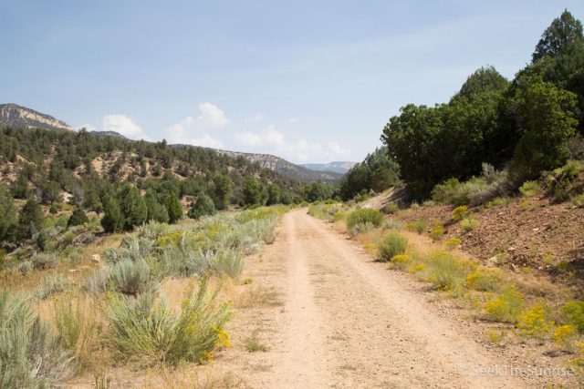
The trail follows an old dirt road for about the first 2 miles. This area is pretty with green grass and large hills in the distance but nothing too special.
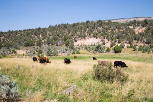
In this area, you will encounter lots of cows, electric wire fences, and not a lot of shade.
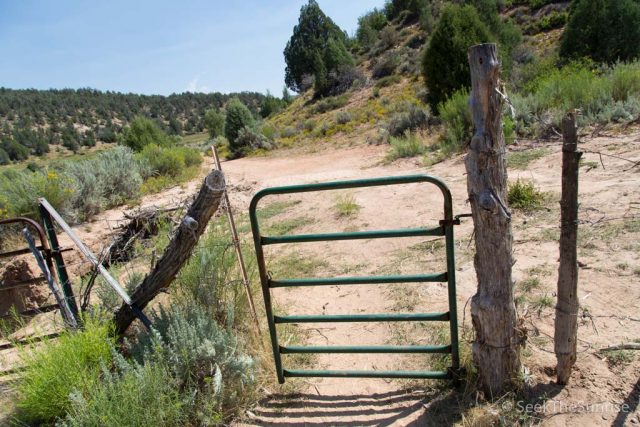
About a mile and a half in, you will reach the end of the four wheel drive portion of the road and will be able to walk through the crude gate to continue on.
Bulloch Cabin
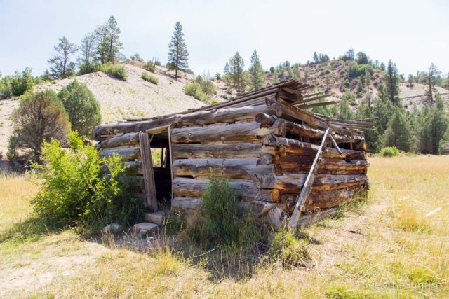
About a quarter-mile from here, you will reach Bulloch’s Cabin, which is an old worn down cabin that was pretty creepy when we were there. It had a torn-up couch and a bunch of other items strewn all over its interior.
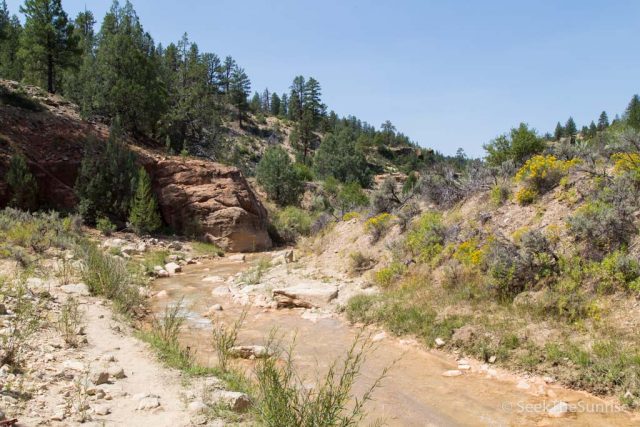
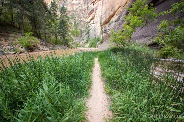
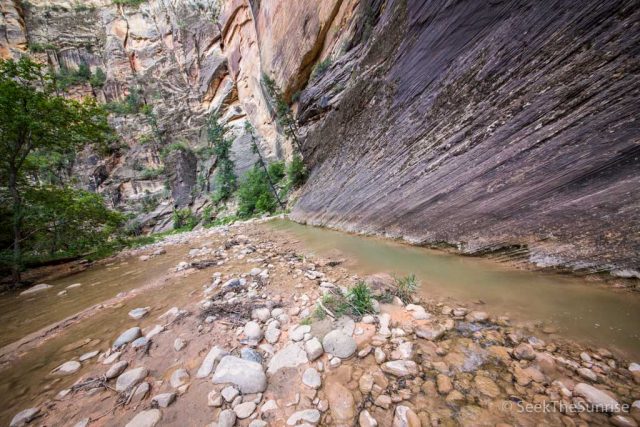
From here, the trail continues to parallel the stream without getting too close to it. It is ,gorgeous but I found myself wanting to see what was next.
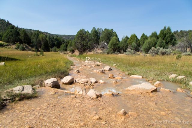
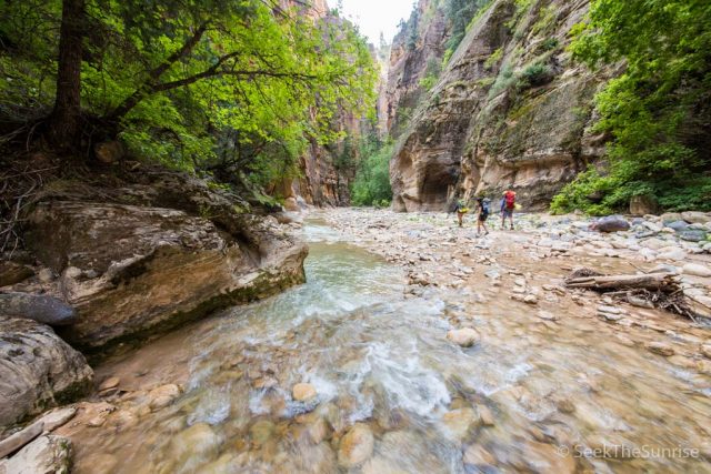
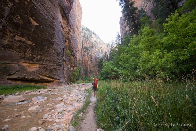
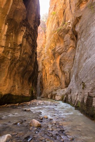
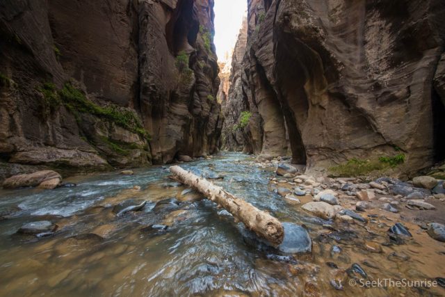
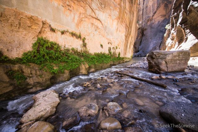
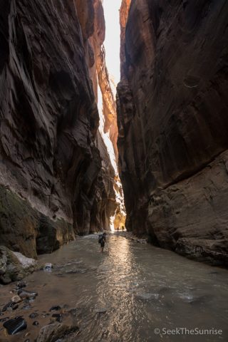
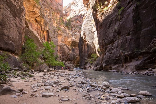
The next portion of the trail takes the beautiful stream and starts to add in the time-worn canyon to it. The canyon itself is not very deep here, but you see glimpses of what you have in store in the narrows. This section is also where you will begin to enter the water as you traverse back and forth through it.
In this area, there are a lot of cows as well, so I would recommend not drinking the water. The first potable water, after you filter it, is at campsite 1, eight miles in so plan accordingly. You will start to notice that the 16 miles and 1,600 feet of elevation loss is actually a lot more difficult when you are walking through the water the entire time.
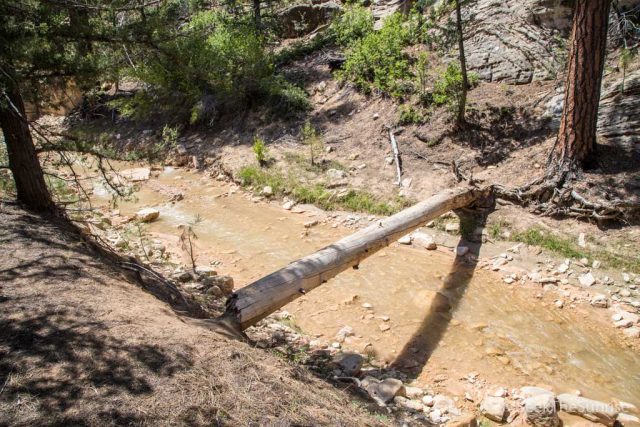
We had a few groups that we traded positions with, but overall we were on our own most of the trip. The trail continues to advance with the canyon getting more profound and more narrow with each step. There are a lot of beautiful spots to see here, and like I said above, each turn brings a new view that beats the previous one.
There are also spots of shade in this section as well, which is welcomed, and we saw a few turkeys on the trail when we came around a bend.
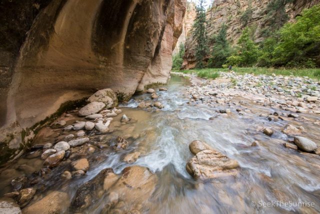
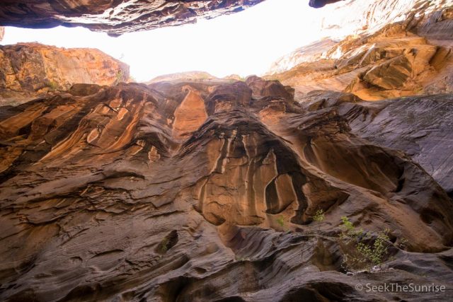
From here, the next point of interest is the start of the narrows. Honestly, I am not sure exactly where that was as there were a half-dozen parts where I said this could be the start of the narrows!
This just means everything is getting more narrow and more deep. The views are more stunning as well, and there were multiple times when I looked up only to realize I was deep in a canyon of at least a hundred feet.
This area is beautiful, but it does seem to take a long time as there are not many points of interest to look out for. That being said, everything here is fantastic, it is just nice to have a goal.
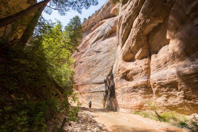
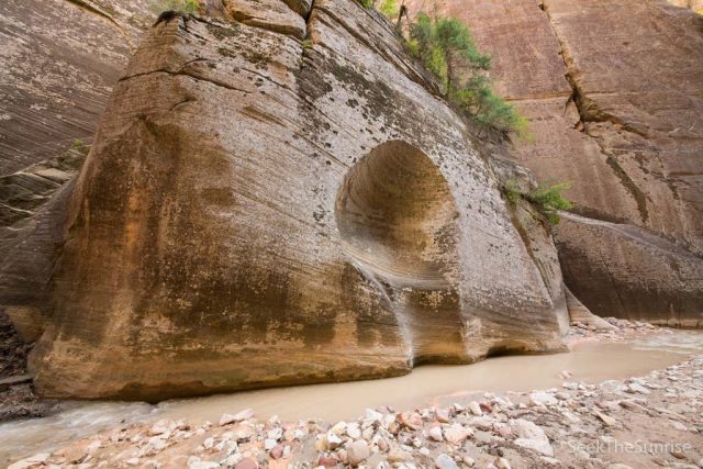
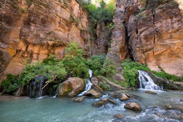
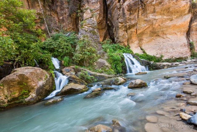
The Waterfall
At about 7 miles in, you will reach the waterfall. This waterfall looks like it cuts off your path, but you can go down the south side around it to get past it.
I recommend hiking back 50 feet when you reach the bottom to see the waterfall up close as well.
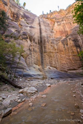
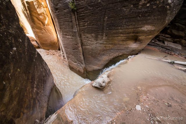
After the waterfall, there are a couple of crazy canyons that you head into, one with a dark feel to it and others that are wider and more inviting.
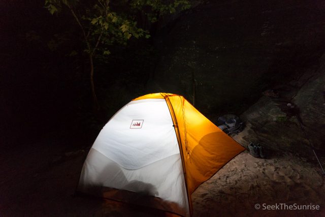
The next point of interest is the convergence of the two rivers and the start of the campsites. Our campsite was number 1, so we were right on the convergence of these two rivers, and it was one of the best campsites I have ever stayed at. The water here was free of cow poop, and the view we had while eating dinner was hard to rival. After hanging out for a while, we went to bed in preparation for day two with it’s even longer mileage and deeper creeks.
Day 2
Since we were at campsite 1, which was the earliest campsite on the hike, we had a full 8 miles to get through before the day was over. We set our alarms for 6:30 AM, which gave us more than enough time to get out at a decent hour with the 1.5 mile an hour pace we had done the day before.
For food, we had backpackers oatmeal, and it was good and an easy meal to make with your Jetboil. I am also a fan of the Jetboil Java add-on, which makes your Jetboil into a French press as well and provides good coffee while backpacking. After that was all done, the camp was packed and water was filled, then we set out at around 8 AM.
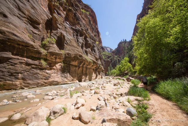
The first two miles were more of what we had become used to on this hike, every corner more beautiful than the last. It was also refreshing to see how the early morning light danced on the tips of the cliffs as we walked through them.
This section of hiking was 70% water and 30% land, so be prepared for that, as that is pretty much how it is for the rest of the trip. The Wall Street area is probably even more water then that, as there are not many areas without water there.
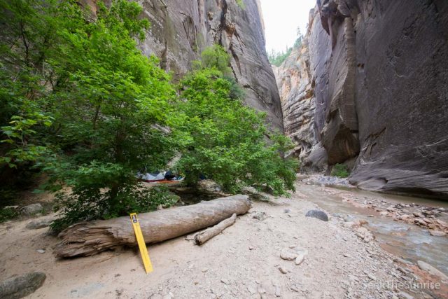
As we walked, we saw all the other campsites; most are around 5-10 minutes from each other, which makes them very secluded at night. Campsite 9 also has a little cave overhang type cut out that you can put your tent under in order to provide protection.
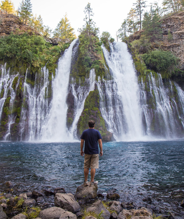
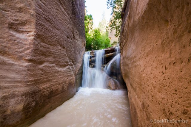
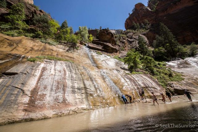
After about 3 miles of hiking, you will make it to Big Springs Waterfall, which is a perfect place for a break and a snack.
Big Springs
I took the opportunity to swim here as well, as I did not want to leave the Narrows without fully submerging myself. It was incredibly cold, so I didn’t last long, but you couldn’t ask for a better place to swim.
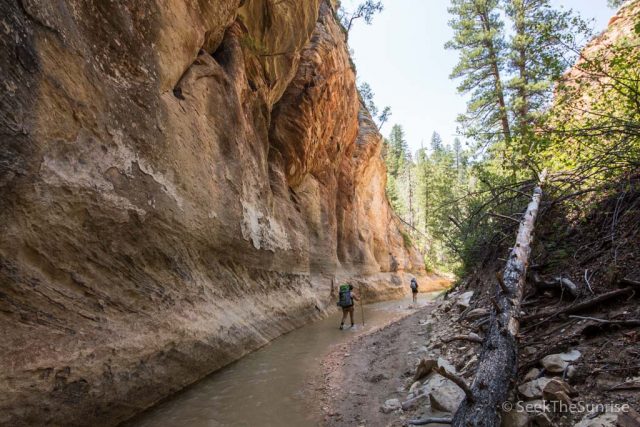
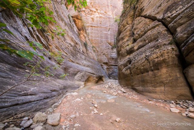
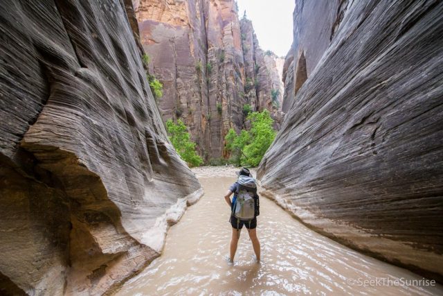
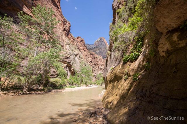
After a leisurely break, we headed towards what is the most amazing part of the canyon, Wall Street.
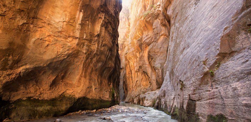
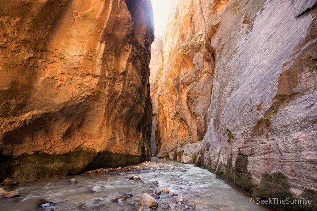
Wall Street
All I can say about Wall Street is wow. I thought that many of the other sections we had gone through were the best, but after Wall Street I can firmly say this is the most beautiful spot in the canyon by far.
This area has massive canyon sides with beautiful hues of orange and yellow and a height that blows your mind. I wish I could have spent all day here as it was that great.
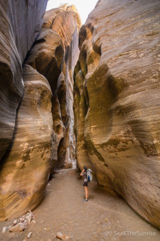
This is also where you will start seeing other people though. It is good that they are experiencing it, but bad because I was used to the beautiful solitude that I had found further up.
My favorite section of the entire narrows is the top photo of this section, which was right near the last third of the Wall Street area. When I turned the corner, it blew me away.
Side note – you can hike here on a day hike, it is about 5 miles from the start, so it would be a long day, but it is possible.
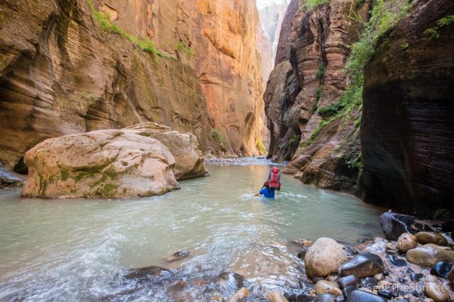
At the end of the Wall Street section was also the deepest part we went through. A few members of my group had to swim while I was about shoulders deep in the water. It was hard to do this with a backpack, but we had put trash bags in our packs to slightly waterproof them, so it wasn’t too bad.
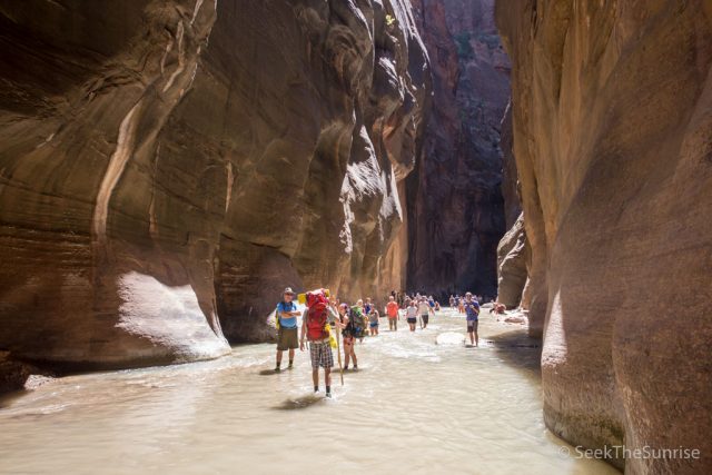
After this, the Wall Street section officially ends with the connection to Orderville Canyon, which comes out from the eastside. From here, you will be surrounded by people the entire rest of the hike, and while the views are still spectacular, they pale in comparison to what you have seen previously.
There are a few exceptions though, like the beautiful hewn large tube-like section cut into the walls about halfway in. It is unlike anything else I saw on the trip and beautiful.
The canyons open up here as well, which allows for more plant life and a departure from the almost all water hiking.
You will know you are reaching the end of the hike when you see Mystery Canyon Waterfall. This beautiful trickle of a waterfall drops about 100 feet on the south side and is always full of people. It is only about a half-mile to the end from here. I don’t have a lot more to say about this section other than that you will see a lot of people, and you will probably be anxious to be done.
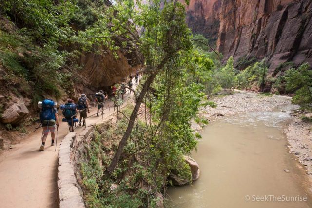
Once you reach the end of the water part, you will have to hike out about a mile back to where the shuttle picks up. This section is beautiful and has a nice concrete path, but you will most likely just be in zombie mode trying to finish so you can take off the backpack. I got a lot of congratulations here as well, which was a fun way to end an epic two days.
After you get back to the shuttle, you can take it back to the visitor center and campground to get back to your car after an epic trip. Really, this is a fantastic hike, and you must do it! Let me know any questions you have in the comments, and here are some more resources as well as an FAQ.
FAQ
How do I get a permit?
You can get one three months in advance from this site.
How do you get water?
Once you reach Deep Creek about 8 miles in, you can filter the water, before that the water is not filterable as it has a lot of cow poop in it.
How do you use the bathroom?
We are told to pee in the water when we talked to the rangers. For number 2, then a wag bag is provided when you pick up your permits, be sure to pack it out!
Will I get lost?
It’s pretty hard to get lost as you are following the water all the way down. Be sure to grab a map when you get your permit though, so you know the approx time/mileage to reach a specific location.
Tips
- Even if you have dry bags, bring trash bags to line your backpack with and ziplock bags for smaller items. Also, an excellent way to pack trash out.
- Baby wipes are also excellent for cleaning yourself / feet / utensils at campground.
- Quick-dry shorts are a must, and neoprene socks are also a good idea.
- A small microfiber towel is a good idea for quick wipe downs and to dry yourself at camp
- Hiking poles are a must, do not do it without! You will stumble around as you can’t see in the water, so you will fall in without hiking poles, I guarantee it
- It was 15 degrees cooler at night in the canyon, plan accordingly
Other Resources
- Barefoot Theory has a fantastic three part guide on the Narrows you can read here.