Hiking from the North Rim to the South Rim of the Grand Canyon is a bucket list item for most hikers. Being able to see the canyon up close and appreciate its beauty on the 23-mile hike is a truly amazing experience. While it should be noted that the national park service does not recommend that you do this hike in one day, this is what we did. After doing it, though, I would not recommend you do it in one day either unless you have been training for months and are in top physical shape. We trained for the better part of 4 months and then set out to conquer the Grand Canyon on a one day hike in early October, here is all the information.
Details
- 23.5 miles and 5,500 feet of elevation
- People say this hike is harder than running a marathon
- DO NOT DO THIS IN THE HEAT OF SUMMER!
- You have to get a shuttle from one side to the other or drive multiple cars and shuttle back
- There are various campgrounds and Phantom Ranch if you want to do a multiple-day hike but be sure to book these in advance.
Pre-trip details
Training
Since this is an intense hike that many consider harder than a marathon, it should never be attempted without a lot of training. My friends and I are in the Southern California area, so we planned to hike over a dozen mountains that built-in elevation to eventually mimic what we would be doing in the Grand Canyon with a hike up San Gorgonio peak. This was in addition to three times a week climbing a local mountain that was over 2 miles and 500 feet of elevation, to keep in shape for the weekend trails. Our training hikes roughly followed the SoCal Six-Pack of Peaks since they are often used for long-distance hiking like the JMT. The last five hikes were:
- Mt Baldy via the Ski Hut Trail (9 miles and 4,000 feet of elevation gain)
- Cucamonga Peak (12 miles and 4,500 feet of elevation gain)
- Mt Tallac (10 miles and 3,200 feet of elevation gain) – This one is in Northern California, but I happened to be in the area so I added it to my training.
- San Bernardino Peak (16.5 miles and 4,700 feet of elevation gain)
- San Gorgonio Peak (18 miles and 5,800 feet of elevation gain)
We hiked San Gorgonio Peak two weeks before we did the Grand Canyon Trail and it was determined whether or not everyone was ready for the trail. This hike goes to a summit that is around 11,500 feet, making it much taller than the elevation of the Grand Canyon but at about the same amount of elevation gain. I would recommend that if you are in the Southern California area that you make hiking this your goal before doing Rim to Rim as it is a good comparison of the difficulty of a one day Rim to Rim hike (it has fewer miles but more elevation and you are hiking at a higher overall elevation the entire time). If you have more questions about training, leave them in the comments.
Time commitment
For us, it was a 4-day commitment to do the hike, you could do it in less, but this was the best way not to push ourselves too hard. Our trip looked like this.
- Day 1 – Drove from Southern California to Williams, Az, which was about 6.5 hours and got a hotel in Williams.
- Day 2 – Drove 1.5 hours into the South Rim of the Grand Canyon, hung out for a few hours, and then got the shuttle to the North Rim. We spent the night at the North Rim.
- Day 3 – Woke up and hiked back to the South Rim. It took us about 14 hours. Then we drove to Williams and got a hotel.
- Day 4 – Drove the 6.5 hours back to Southern California
Hotels
Hotels on either the North or South Rim are hard to come by, and you need to plan it in advance so that you can secure one. We were lucky enough to find one night at the Grand Canyon Lodge on the North Rim, so we grabbed it and then booked the entire trip around that night. Hotels in Williams were easy and cheap, so that was not an issue.
Shuttle
The shuttle needs to be booked in advance, but according to their website, they add shuttles as required, so it doesn’t seem as big of a deal. I still wouldn’t wait to book it once you have your hotel, though.
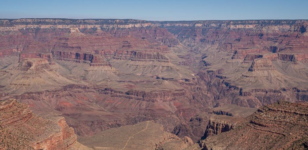
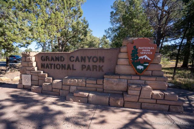
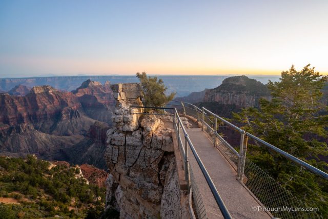
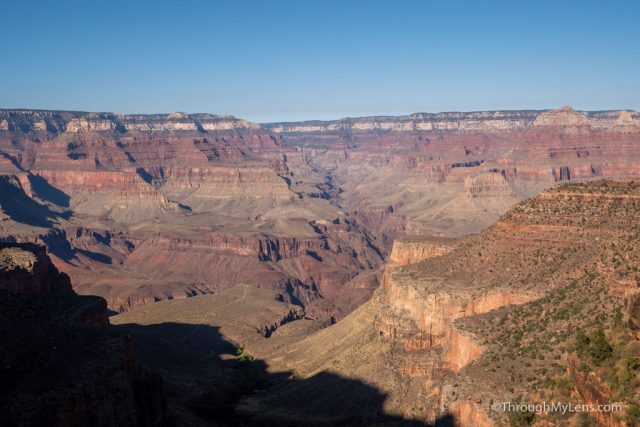
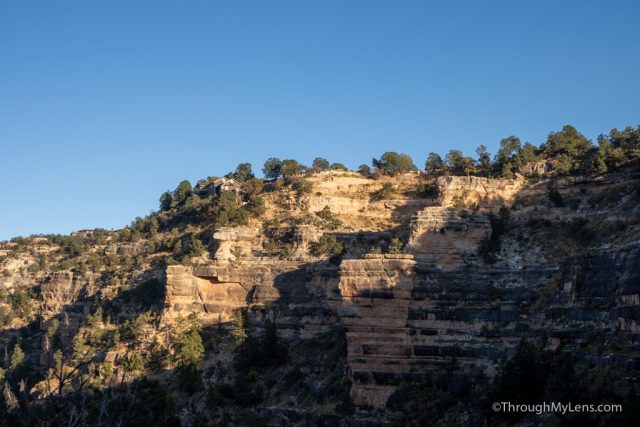
Grand Canyon
We got the Grand Canyon at around 10:30 AM to make sure we had no issues getting to the shuttle on time and to maximize our time at the Grand Canyon. Since we didn’t have to meet the shuttle until later, we took the time to explore the South Rim.
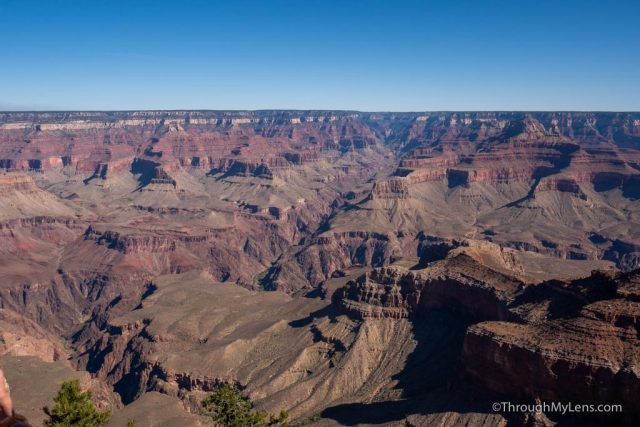
We started at the Mather Point and Visitors Center parking area and began walking along the rim trail, taking in the view.
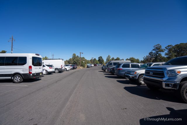
From the visitor’s center, we took the 20-minute drive to the backcountry information center, where you can park your car while on the hike. Here you can check in with the information center to ask for status on the water on the trail and any updated information on the trail. I highly recommend you check in with them before the hike.
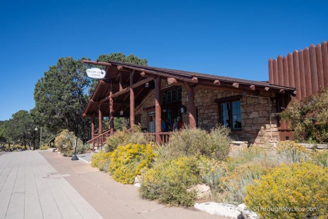
After checking in with the rangers, we headed over to Bright Angel Lodge and got on the shuttle for the 4-hour drive to the North Rim.
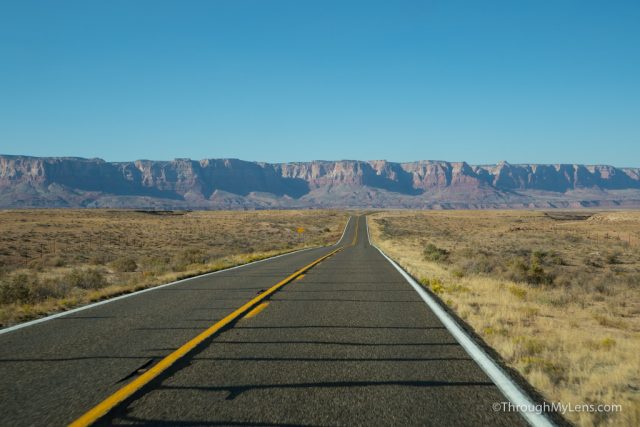
The drive is beautiful, and I enjoyed being able to see more of the area that surrounds the Grand Canyon. There were two stops along the route where you can get drinks and food or where you can use the bathroom if needed.
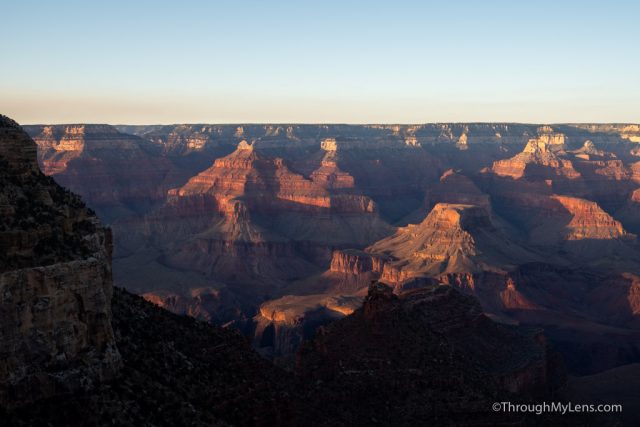
From the road you turn off of for the North Rim, it is still an hour to make it to the Grand Canyon Lodge. This part of the drive was especially nice since the sun was starting to set, and some fall colors were coming in. We also saw a lot of animals on the drive as well.
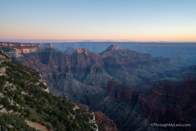
We checked into the lodge, watched the sunset, and grabbed some dinner.
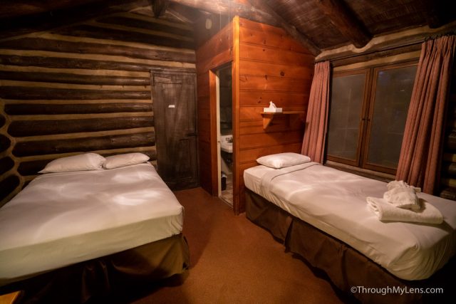
Also, note that the lodge provides a free morning shuttle once per hour (first come first served), and when we got a chance to sign up, only the 3 AM or the 6 AM was available, so we went for the 3 AM. If you don’t take the shuttle, it is an extra 2 miles to the trailhead.
The Hike
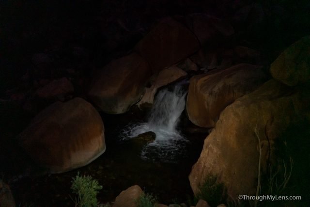
At 3 AM, we grabbed the shuttle and were on the trail by 3:15. This was the only unfortunate part of the hike, as we didn’t get to see much of anything for the first few hours. It would have been better to do a two-day hike so that would have seen more, and hopefully, I can do it again as a two-day hike.
It was a nice downhill walk to begin the hike though, we just used our headlamps and pushed on through the dark. It is a popular trail, and even at 3:15 in the morning, we passed multiple people on the trail in the first few hours.
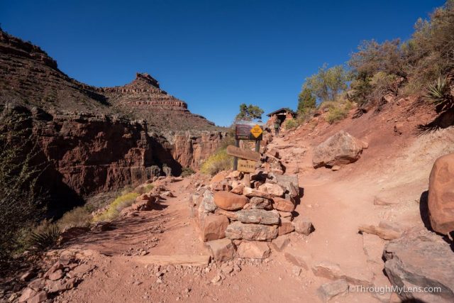
The first main stop was at the Manzanita Rest Area, which is about 5 miles in. There were water fill-up stations and a bathroom here, and we took a break to have some snacks.
The next mile and a half to Cottonwood Campground was still pretty much in the dark as the sun was just starting to rise.
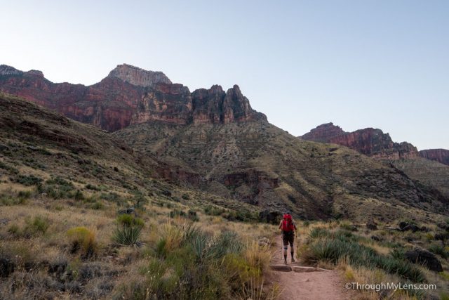
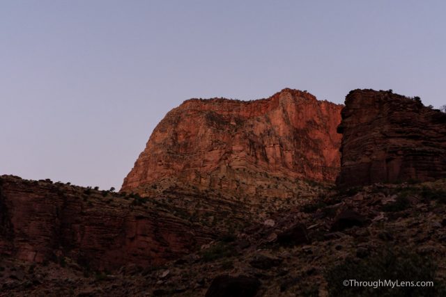
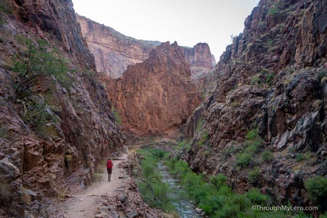
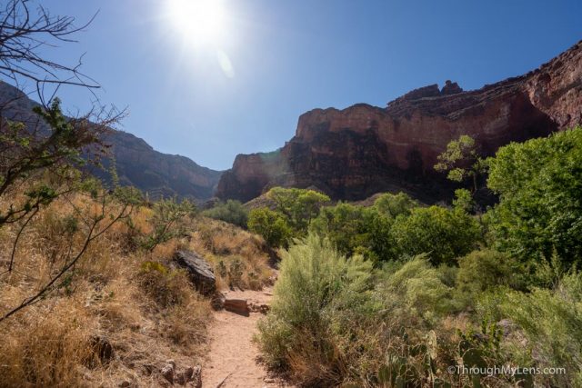
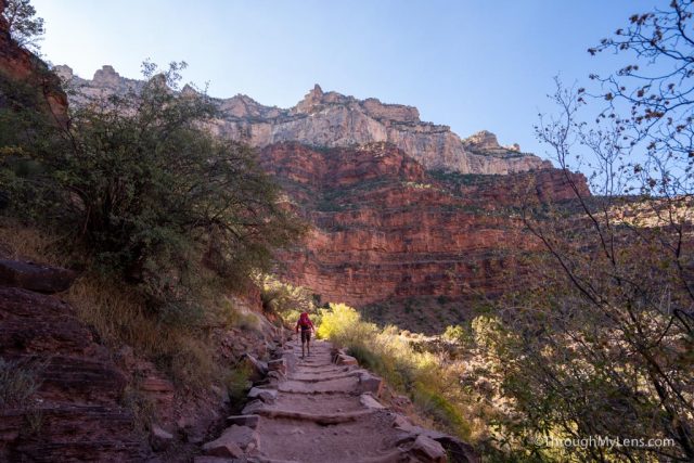
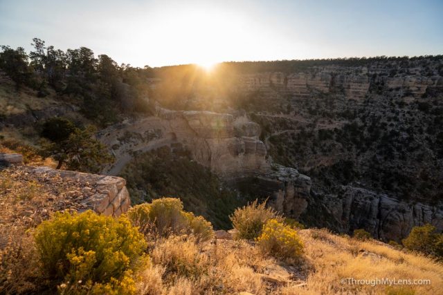
When we reached Cottonwood Campground though, the sun was finally up, and the rest of the hike was in the light.
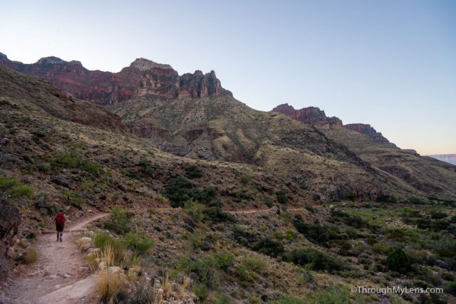
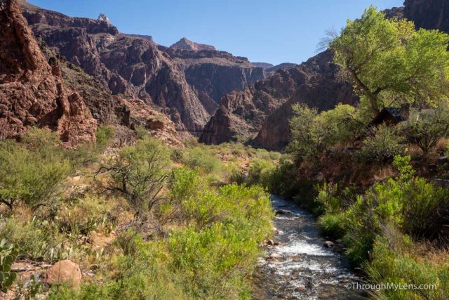
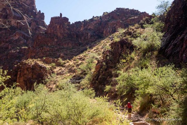
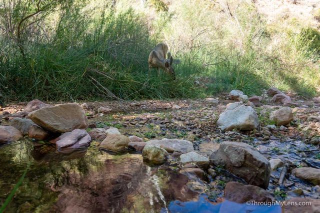
From Cottonwood Campground, we were in a large canyon, and the sun was lighting up the tops of the mountains around us. We even saw deer as we walked through this area.

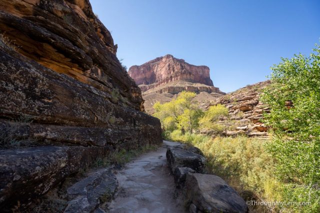
At around 8 miles, we made it to the spur trail that heads to Ribbon Falls. This adds about a mile and half to the trial, and the bridge was washed out, so we didn’t do it.
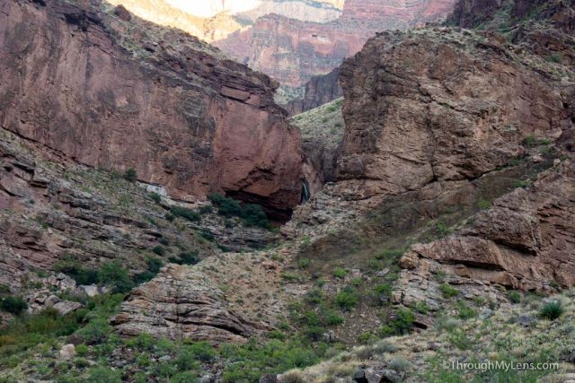
As you continue up the small hill, you will eventually see Ribbon Falls in the distance, so you do get to see it even if you don’t hike to it.
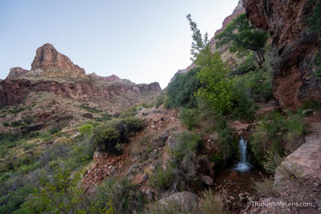
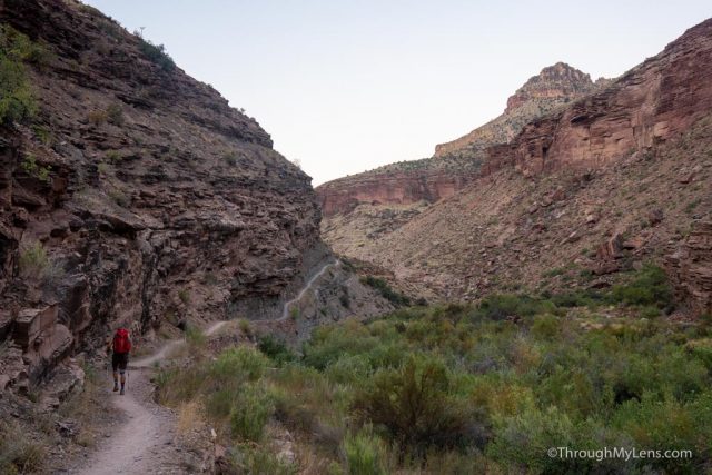
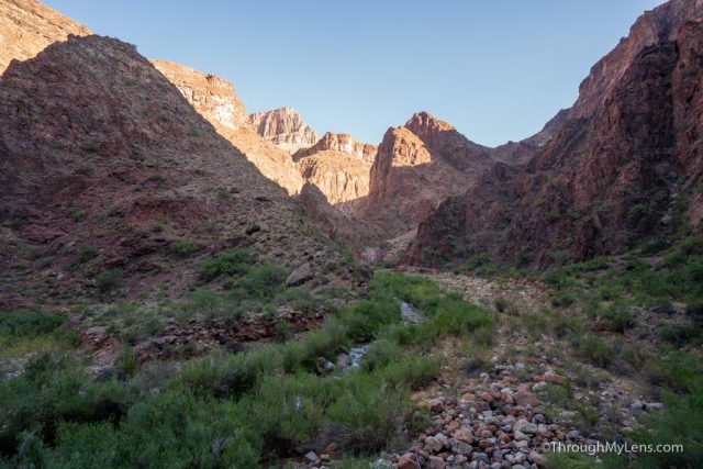
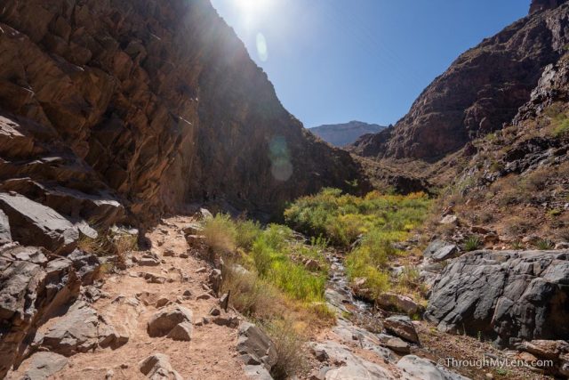
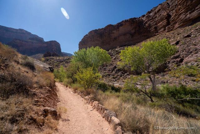
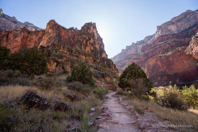
From Ribbon Falls, there is a long section with no real points of interest as you proceed through the canyon on a gradual downhill.
The trail here is fantastic, and it continued to blow me away as I turned each new bend.
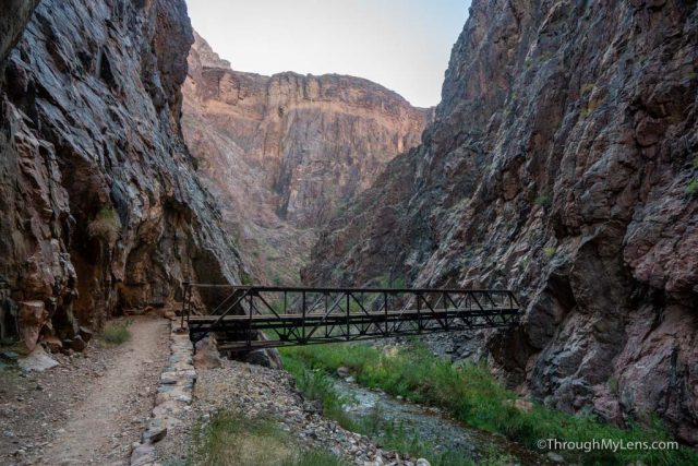
The trail follows the creek as well, and there are a bunch of old historic bridges in this section.
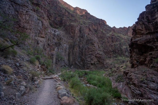
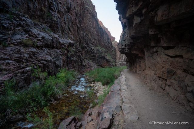
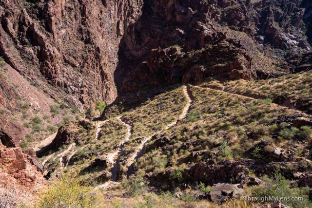
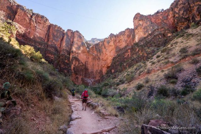
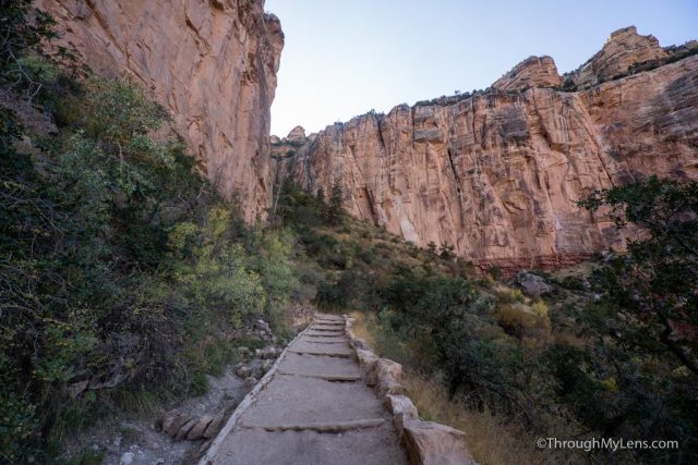
Eventually, as you near the 13-mile mark, you will make it to an area known as the box.
This area is a narrow canyon with big stone walls on both sides, and it is said to hold in the heat well. I was told it could be up to 20 degrees hotter in this section if the sun is heating it up. Everyone I talked to recommended that we get through this section as early as possible, and when we got there, it was not hot.
It was a beautiful section to walk through, and one of my favorites on the trail.
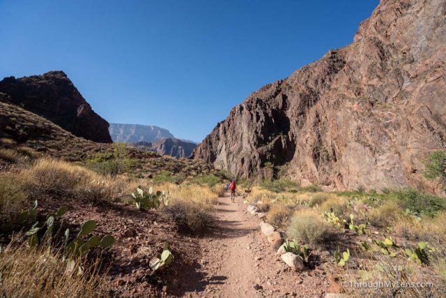
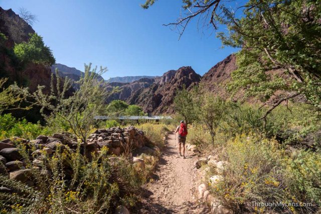
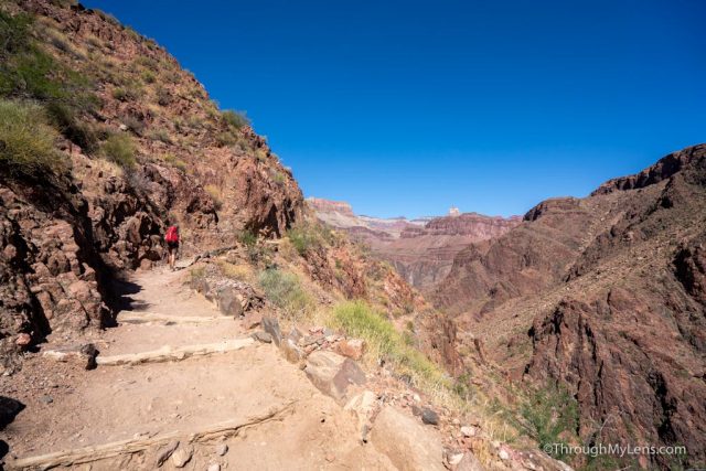
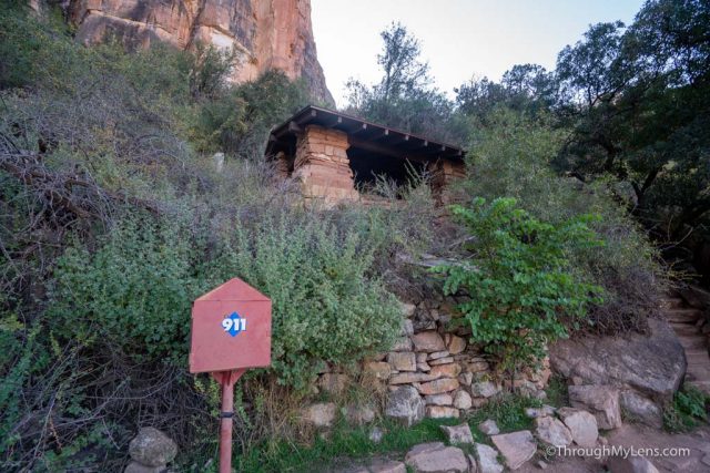
As we left the box, the canyon walls got wider, and we made it to a nice oasis of green plants next to Bright Angel Creek, where Phantom Ranch is located.
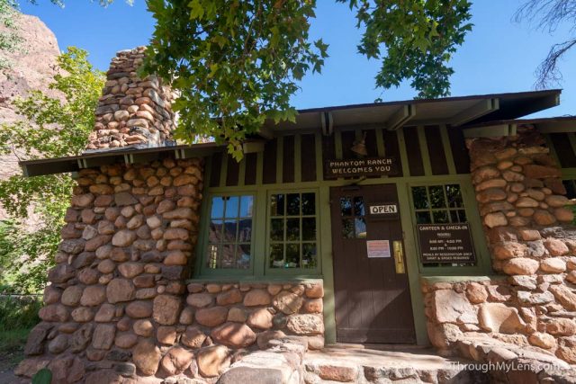
Phantom Ranch is 16 miles from the start of the trail, and we got there right around 10:30 AM. It is a beautiful area to relax with lots of shade and picnic benches.
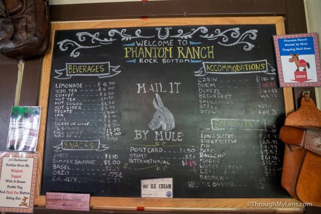
It also has a store that sells cold lemonade, which is a significant highlight on this hike and some of the best lemonade I have ever had (I am sure because I was thirsty). You can also mail a postcard from here as well, and it will be delivered out of the canyon on a mule.
After relaxing for about 30 minutes, we set out.
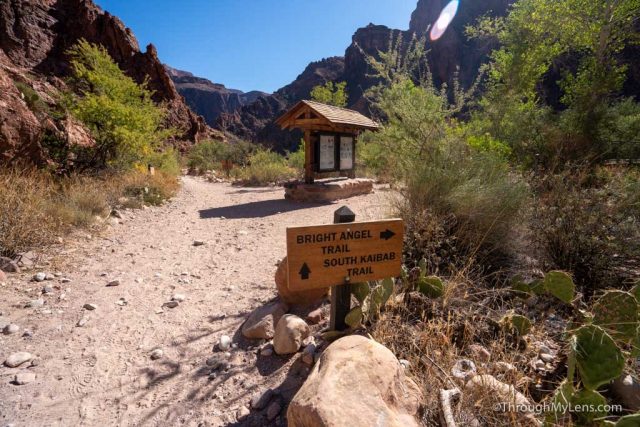
From here, you leave the oasis of Phantom Ranch and go past Bright Angel Campground, which is another popular spot for multiple-day Rim to Rim trips.
The trail then breaks with the South Kaibab Trail and the Bright Angel Trail. The South Kaibab Trail is shorter by two miles, but it is more elevation gain, and has no real shade or water. Because of this, most people opt to hike the Bright Angel Trail instead, and that is what we did.
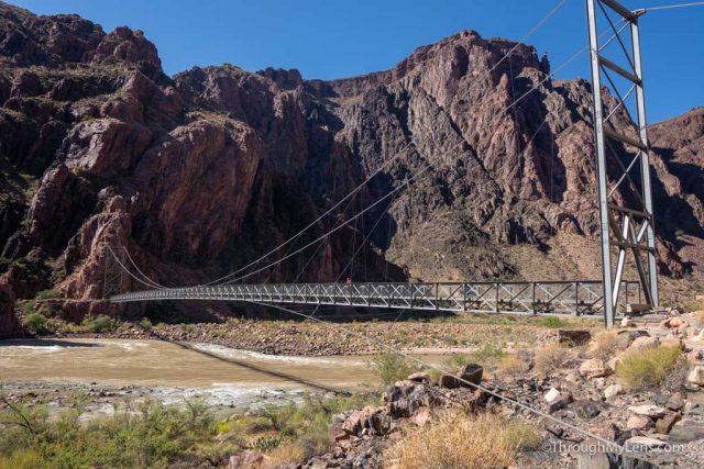
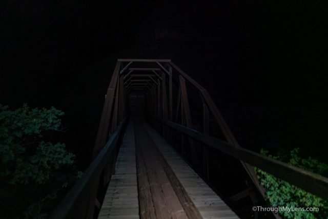
At the split, we stayed on the Bright Angel Trail and went across the Silver Bridge, which takes you over the Colorado River.
This bridge was one of my favorite things I saw on the trail and was cool to be able to walk across it.
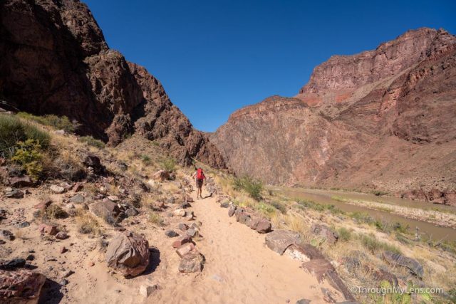
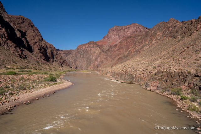
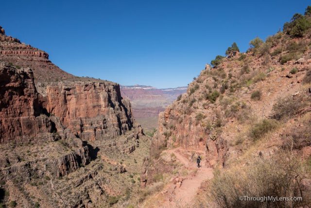
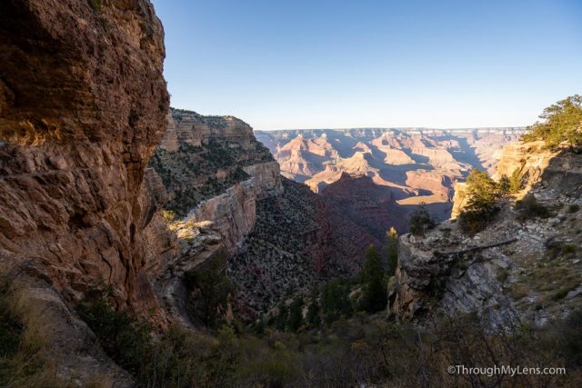
From here, the trail starts the uphill. It climbs alongside the Colorado River and gives you some great views of the canyon walls.
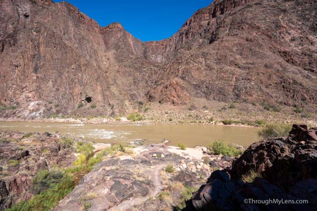
As you top out on the small hill, you have to walk back down to the Colorado River again, which means that you lose about 250 feet of elevation.
Once you make it to the river, you will head inland, and you will start the uphill that doesn’t end until you make it to the South Rim.
The trail is exposed and in the sun as well, making it pretty tough, especially if it is in the heat of the day.
The uphill is still gradual as you head back, until you eventually make it to the start of the switchbacks.
The switchbacks here were entirely in the sun for us, and they were brutally hot (this was in early October as well).
Eventually, we made it to the top of these, and the trail evened out a little bit as it went for the next mile and a half to Indian Gardens.
There was a creek here at least, and we used the water to wet out buffs and cool our temperature.
Eventually, we made it to Indian Garden, which is about 4.5 miles from the South Rim, and this is where we took our last big break before the climb out. I even took my shoes off here and soaked them in the water, along with my shirt, which helped to cool me down.
After relaxing for about 30 minutes, we set out again and walk the half-mile past Indian Garden Campground to the South Rim wall.
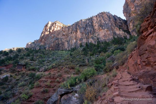
From here, it is was nothing but switchbacks to the rim.
This section is tough, but luckily the sun was not directly on us for most of the switchbacks, so we were able to chug along in the shade.
The views continue to get better and better as you make your way up, but the switchbacks will seem relentless.
Eventually, you will reach 3 mile resthouse, which has water and a bathroom, and it is a good spot for a break.
The switchbacks continue for the next mile and a half, and they seem to get steeper as well.
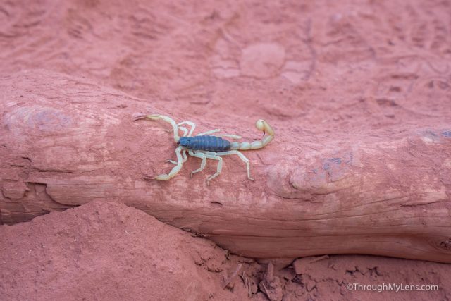
We saw a scorpion as we made our way up, though, which was pretty cool.
The section from 3 mile resthouse to 1.5 mile resthouse seemed like the longest section on the hike for me.
We then made it to 1.5 mile resthouse, which has more bathrooms and water and to another short break.
From here, the adrenaline picked up since we only had 1.5 miles left.
It was a tough push still, but the end was in sight.
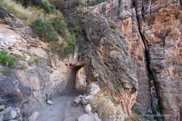
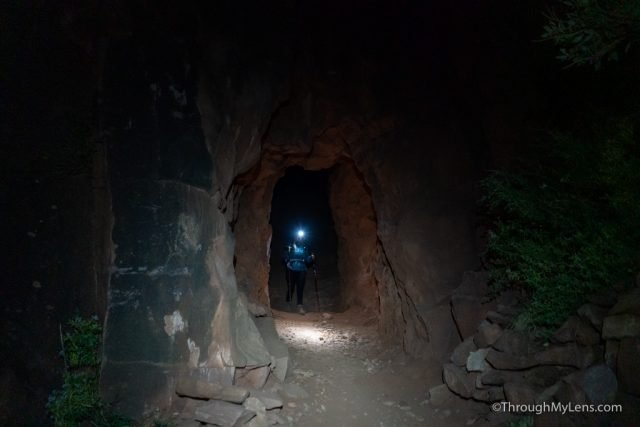
The next point of interest is the lower tunnel, which means that you are getting close.
From there, it is just a few more super long switchbacks to get to the rim.
It gets easier when the rim comes in view as well, but you will be passing lots of day hikers whose chipperness you will probably not match. Haha.
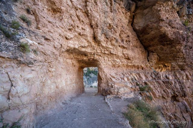
As you go through the upper tunnel, you will see all of the people looking out over the rim, and you only have to walk another tenth of a mile to the start of the Bright Angel Trailhead.
Once we finally made it to the top, it was one of the most remarkable physical achievements I have done. It was a brutal hike and not one that I would recommend or do again, but it was undoubtedly an amazing one.
You can watch this video if you want to see my whole experience and let me know what you think in the comments.