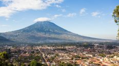
Guatemala, the land of the volcanos, has 33 of these massive mountains dotting its landscape. Most can be climbed but a few are active which is too dangerous for a visitor. If you are looking to only do one though and you are in good shape, then you really should hike the second largest volcano and the third largest mountain in Central America, Acatenango. It is an epic single day adventure that allows you to look down from its summit onto an active volcano.
Details
- 13,069 Feet Tall
- Should get a guide service (mine was $59)
- 8 miles round trip
- 5000 feet of elevation gain
Video of the Hike
A Note of Warning
As you can see from the details above this hike is not an easy one. While the mileage itself is relatively short for a hike like this, the amount of elevation you gain and subsequently loss in that short period is massive. To put this in perspective, Mt Whitney gains around 6,000 feet but it has a round trip of 21 miles. So make sure you are prepared physically and mentally to take on a challenge like this before attempting. Many of the guide services offer overnight trips which I would recommend for an “easier” hike.
Guide
We chose to go with OX guide service as my friend had heard good things about them. You need to book the hike at least a few days in advance and they will only do it if they have at least 3 people going. There are many other services available as well but none that I have tried. Could you do this mountain without a guide? Sure, you technically could but the trailhead itself is not even marked and while the trail is relatively easy to follow there are almost no signs to tell you if you are going in the right direction. I would recommend not attempting it without a guide but that is your call.
The Hike
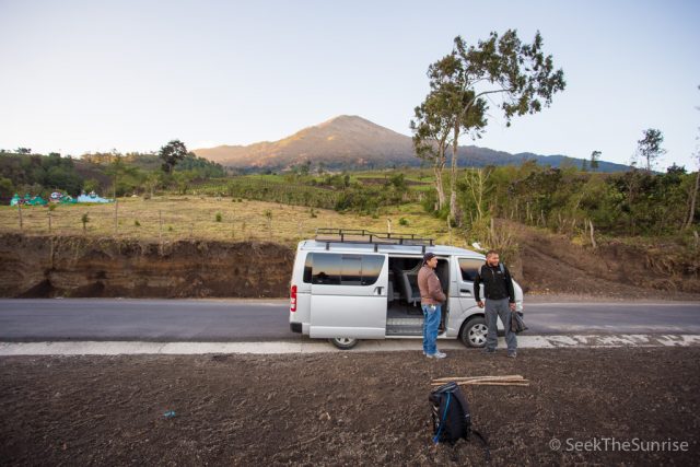
Now we get to the fun part, the actual hike! I broke the sections down into the terrain you will see on the hike. After arriving at 5 AM (the hike time is 5 AM to 5 PM) at the guide service for an hour’s drive to the trailhead we loaded in immediately and were on our way. This road is very rough and you will be bouncing all over the place most of the way. The trailhead itself is literally on the main road with no signs so our guide merely pulled the van over and we were on our way.
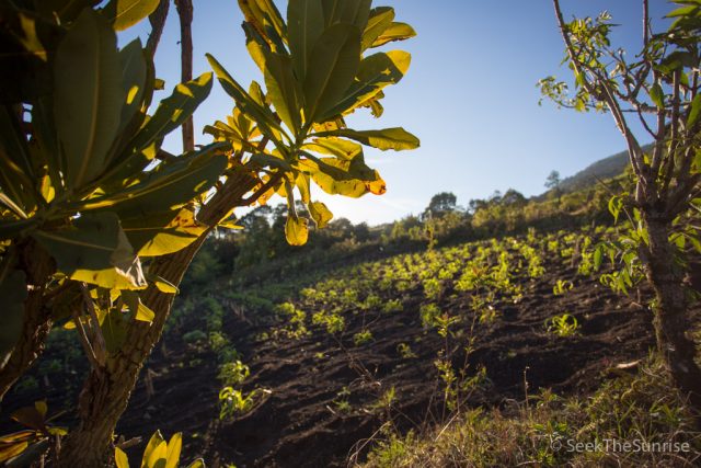
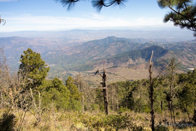
The Farmland
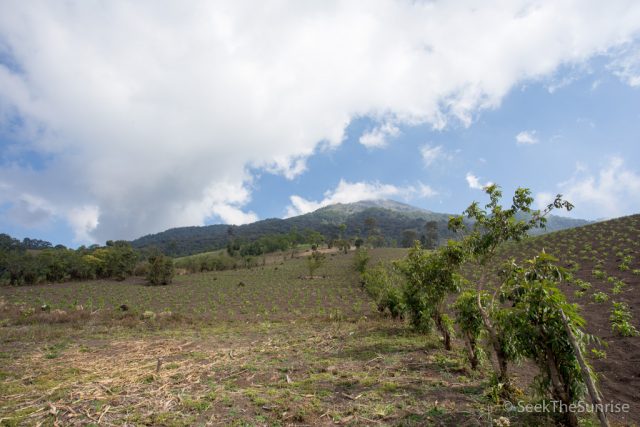
The trail starts heading up a gully that I would assume is a runoff to the farms that flank your left and right side. The sand here is loose and if you are struggling during this part, believe me, it does not get a lot better. It is dusty and steep but it is at least a good indication of what to expect.
When you exit the gully you will be in the middle of a bunch of corn farms. When we were in this section we got to see the sunrise over the hillside and it was amazing.
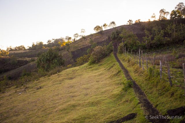
You will continue to walk along the farms themself before you reach the start of the next and longer section, the jungle. I would rate the farm section as one of the more difficult sections of the hike just because the rock is so loose, so you will be sliding a decent amount.
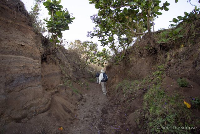
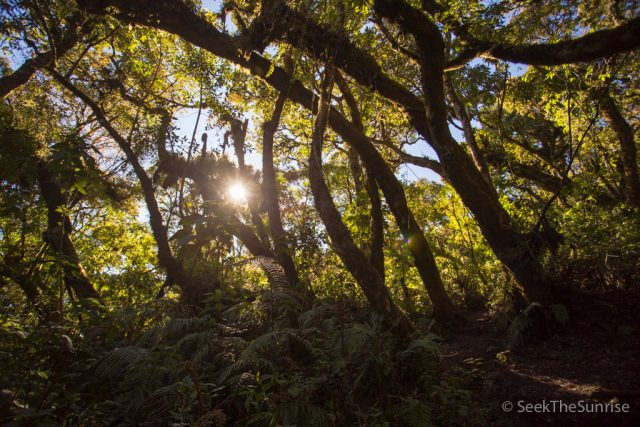
The Jungle
This section is insanely beautiful and you will be in it for a decent amount of time. The trail continues to head up here but you do have the benefit of switchbacks, which really does make it a little less intense.
The jungle section has two small huts as well which provide shade and benches you can rest and eat at.
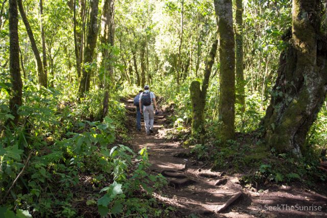
This section is overwhelmingly green and when the sun was shining through it was beautiful It made the long slog through it less difficult.
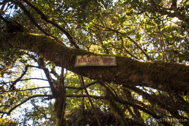
This is also where I saw the only sign for the volcano I saw all day. It was an awesome sign but this is the reason why I say you should bring a guide.
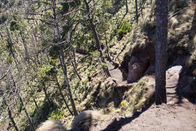
After a mile, you will be exiting the jungle and will move onto the cloud forest.
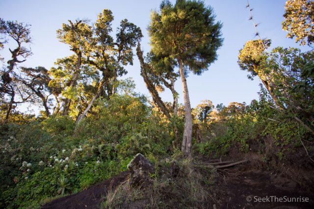
The Cloud Forest
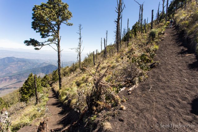
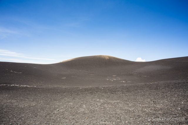
This section exits the shaded and beautiful jungle and trades it for a more barren landscape with lots of scattered trees and shrubbery but little else.
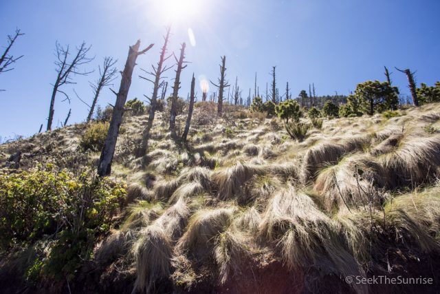
This section is where you really start to feel the elevation as you are well over 10,000 feet and the climb continues at its almost 40 degree incline.
When you are walking this section you will get the first glimpse of how far you have come and it is pretty mind-blowing.
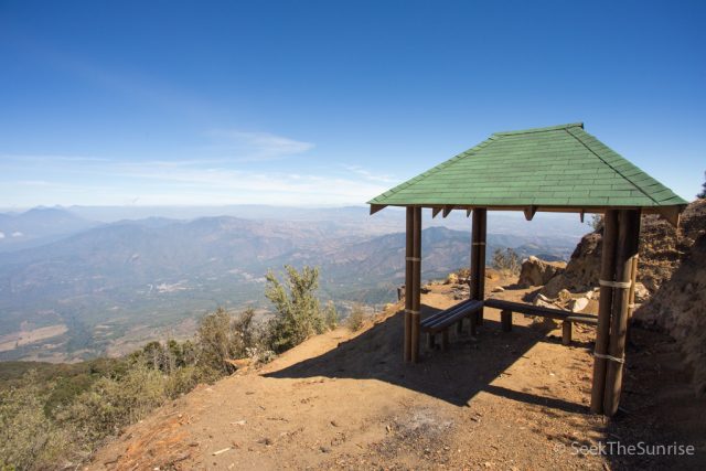
Also, this section has the last of the little huts with benches and I would recommend taking a break here as it is well shaded and has an amazing view. This is what I would call the half way point.
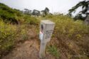
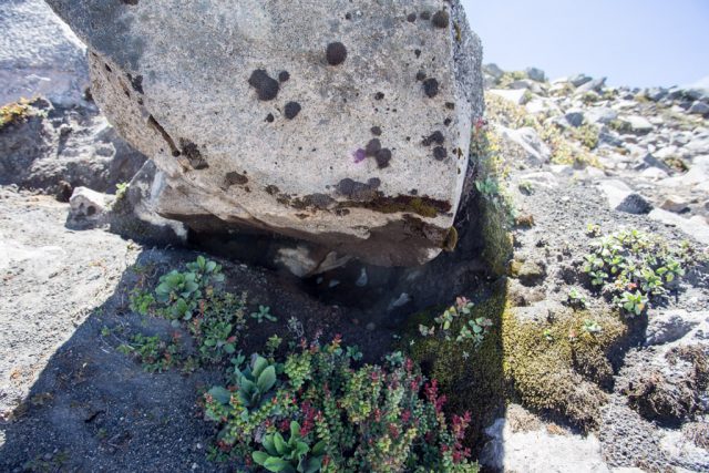
The terrain continues up via switchbacks and there are even sections to navigate here that require you to climb rugged stairs with rocks you hold onto. The cloud forest does not have much shade so be sure to rest and drink water when you see a section of shade, especially if it is a hot day. I found that the shrubbery you saw during the last portion of this hike was pretty nuts and very unique, here is a photo.
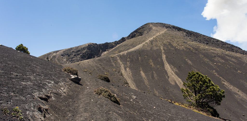
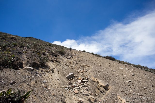
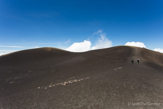
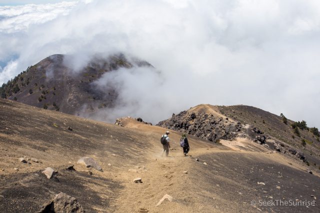
After topping out of the cloud forest you will reach the saddle.
The Saddle
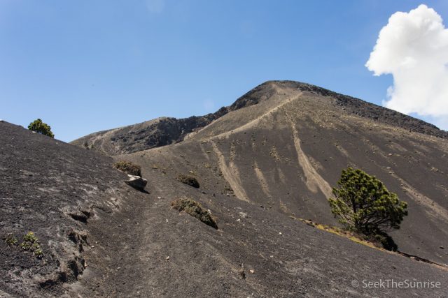
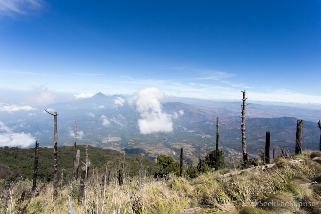
As soon as you exit the cloud forest you will be shocked by how barren the landscape is. It feels like you are on the moon and it is crazy to see the clouds going by you at your eye level.
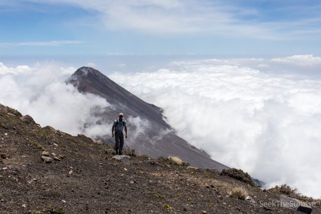
This section was so beautiful but also daunting at the same time as it is the first time that you will see the summit. We hugged the left path all the way to the base of the saddle and spent 20 minutes resting here before attempting the push up to the summit, which is the hardest part of the trail. The wind really is whipping through here most of the time I am told, it was when I was there so I would highly recommend a windbreaker, I was glad I had mine.
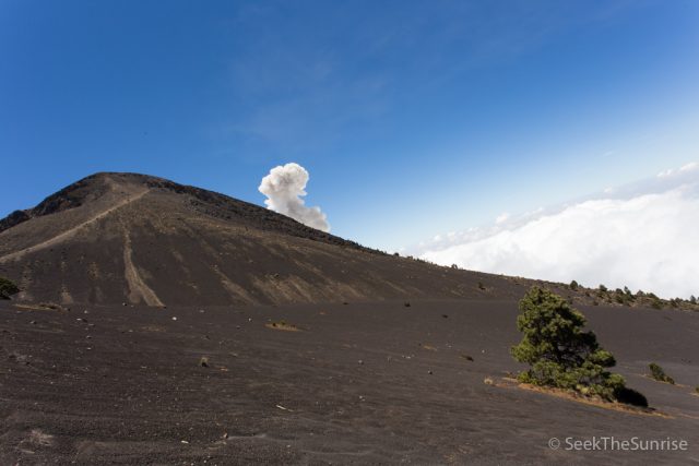
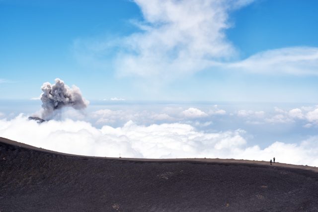
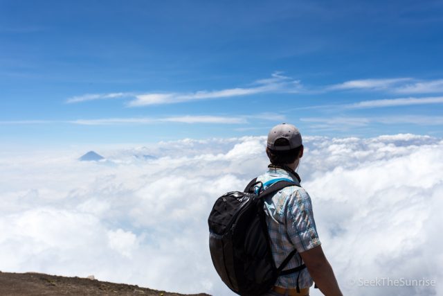
If you are lucky you might even here / see smoke from an explosion on Fuego when you are here. You can’t see the mountain itself but you can see the smoke coming over the summit as it is about 2 miles away.
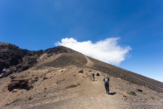
Once you have caught your breath at the 12,600-foot elevation proceed up the last section to the summit. I won’t lie to you, this section is really hard. The incline is at least 40 degrees and the lava rock terrain is so loose that ever step forward becomes a half step backward. If you have made it this far though you can do it! Just put one foot in front of the other and breathe.
When you reach the top of the sandy section you will need to navigate/scramble on rocks to get to the summit.
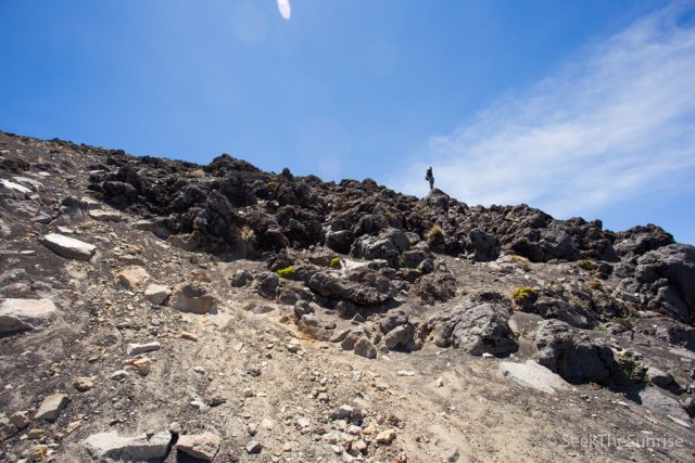
Be careful here as the rocks are still loose and the fall would be potentially life-threatening.
I don’t like heights so this part was pretty nuts for me but I just kept my head down and kept moving forward.
About 25 feet below the summit the guide showed me a place where the methane gas escapes from the volcano itself (this one is dormant not extinct). It was crazy because you could reach your hand in and feel the warmth.
After that, I took my last steps and reached the summit.
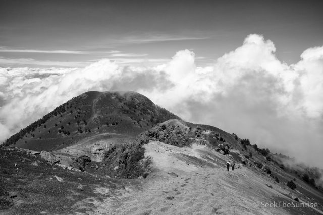
The Summit
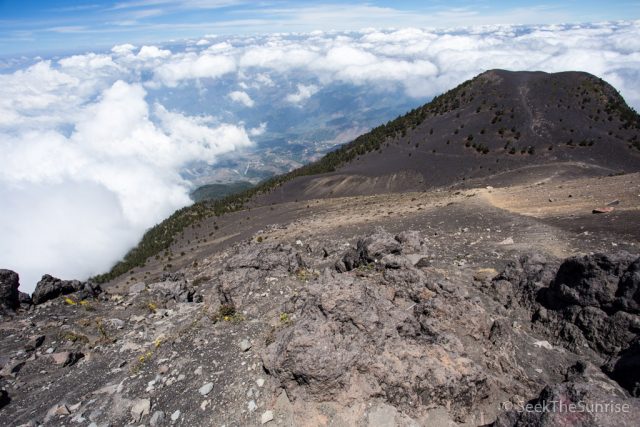
At 13,069 feet this summit is no joke. I was incredibly stoaked to make it to the top and right when I got there I saw my first of many gas explosions on Fuego below. I was in awe as the brown smoke blew out of the volcano below us. It was one of those experiences you will never forget. I happened to catch this awesome picture of my friend Blake coming back up as he had made it to the summit before I did.
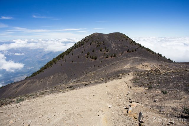
The summit itself is a pretty large volcanic crater that is completely closed and that you can walk around the entire exterior of.
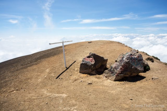
The high point is in the northwest corner (I believe) and it has a few scattered boulders and a small cross.
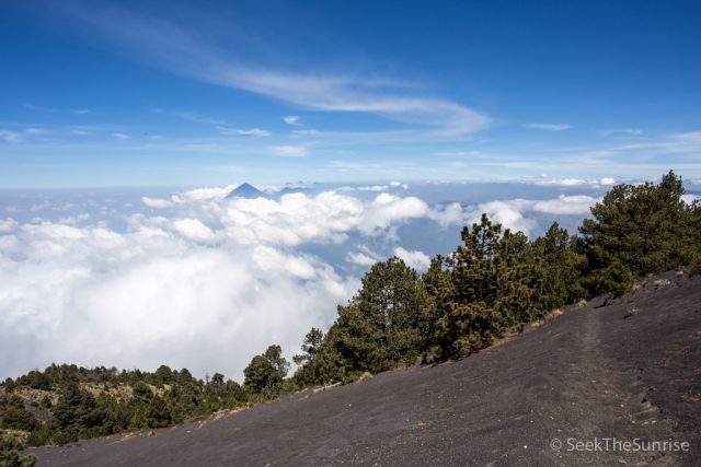
I would recommend walking around the entirety of the summit so that you can see the view from all angles. When we were there it was like a sea of clouds, but it really did make you think you were on top of the world.
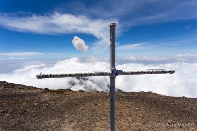
There is another small cross here as well that was an awesome picture with Fuego in the background.
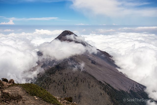
After taking it all in we went to the corner diagonal of the high point and grabbed a seat on the rocks while we ate and watched Fuego explode. Yes, I literally got to sit and eat my lunch while watching an active volcano spew smoke and gas below me, it was a once in a lifetime experience.
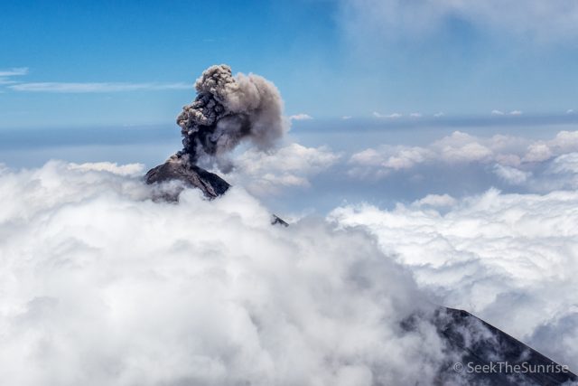
Here is a video timelapse of the clouds flowing over with a small gas explosion at the end.
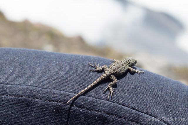
On top of the mountain, there was almost no life except for a few bees and a few mini lizards. Our guide picked one up to show us and it was about the size of a quarter. It was so crazy how barren everything was up here.
After soaking it all in we started the descent.
The Descent
Like you can imagine this part is pretty crazy, especially at the beginning when you are exiting the summit. Be careful and sure-footed with the very loose rocks as you make your way back down.
I would recommend trekking poles as I used them a ton on the way up and the way down. Also, if you have knee or ankle problems consider a brace.
For us, it was about four and a half hours up and 2 hours down. This is relatively fast as our guide said it can take people up to 6 hours to get to the summit but everyone hikes their own hike so make sure to take your time and be safe.
If you are looking for a unique experience then you must hike Acatenango it is one of the best summits I have ever been on and it comes with a sense of accomplishment you don’t often get. Even though my body hurts as I am writing this the day after the hike I cannot recommend this amazing experience in Guatemala enough, make sure to add it to your bucket list. Let me know your thoughts in the comments.