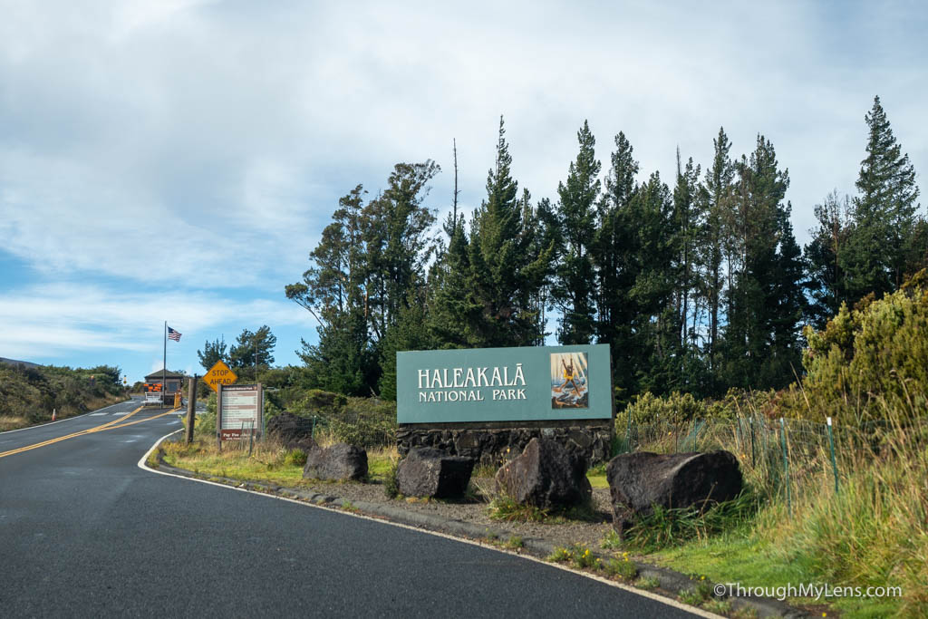
Haleakala National Park takes up much of the land in the middle and eastern parts of the island of Maui. The national park encompasses a 10,000 volcanic crater with an observatory right at the top and over 30,000 acres of land that leads down to the ocean on the island’s east side. I couldn’t find much information on the park when I went, so I wanted to make this video and share how I experienced this beautiful place over two days. Here is all the information, and let me know if you have more questions on how to visit Haleakala National Park.
The park’s two districts
First up, the park is broken down into two main districts that are not connected via a road. While it may be possible to see the sunrise on the crater and then drive all the way out to the coastal district of the park in one day, I would highly recommend you not try to do that and to focus on one part of the park each day.
Summit District
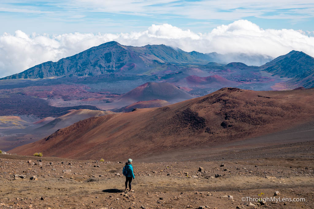
The summit district is the easiest to access from Central Maui and is popular for its scenic drive and many lookouts and trails. The most popular trail here is the Sliding Sands Trail but more on that later. This district also has an observatory at the top, and some tours will take you from Central Maui to the summit if you don’t want to drive.
Kīpahulu District
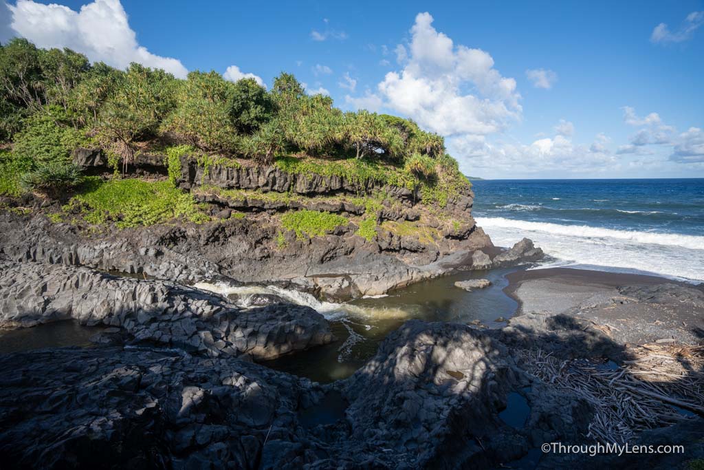
This part of the park is often visited on the road to Hana road trip. After passing Hana, many people will continue to the seven sacred pools and the Pipiwai trail, both part of Haleakala. This area has a visitor center and a parking lot to access both trails but only a little else to see.
Is there cell reception in the park?
We had very limited reception while at the summit and the viewpoints on the way up. In the crater, we didn’t have any reception during the hike. While at the coastal portion of the park we didn’t have any cell reception at all.
How long does it take to drive to the park?
Both of the parks require you to drive to best experience them. The Haleakala summit takes about an hour and a half to drive to the top of, and it is a windy road that climbs about 10,000 feet. Getting to the coastal district is via the Hana Highway. It will take about 3 hours from central Maui without stopping at all. This road is very windy and narrow, with many sections that only one car can pass at a time. It is a beautiful drive though, and you can see my full video on the drive in the description.
How is the weather at Haleakala National Park?
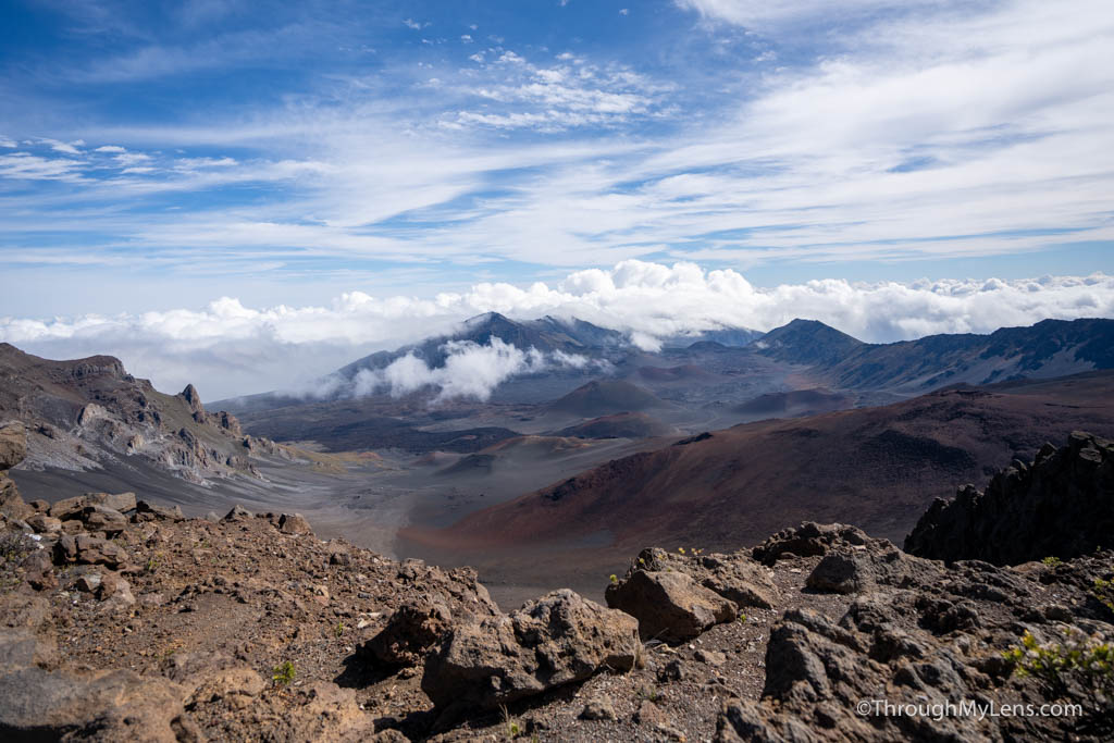
Before commenting on the most popular trails, I want to mention the weather. It is hard to plan for the weather here as the mountain makes its own. I have seen days where the mountain is as clear as can be and others where you can see the summit all day. When you are on the mountain, you will often go in and out of clouds as you make your way up, and you can have sun for 5 minutes and rain the next. On my last trip, I went up for sunrise, and it was all fogged in, then two hours later, I hiked the sliding sands trail without many clouds in the sky. The Pipiwai trail often has rain as well, since it is in a rainforest-type climate at the bottom of the mountain. Be prepared for anything, and know that sunrise or sunset is never guaranteed. The national park service has a webcam that you can see from the top to check the weather.
Reservations at Haleakala National Park
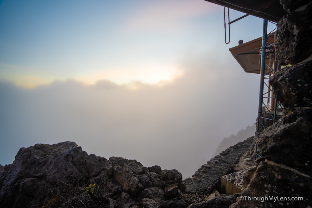
Speaking of sunrise, if you want to experience sunrise from the top of the mountain, you need to get a reservation. These usually come out two months in advance, with a small portion released two days prior, but be sure to double-check that as it does change. During busy times like the summer and holidays, the reservations can sell out immediately. Remember that if you want to see sunrise, you need to leave at least 2 hours before it is supposed to happen if coming from central Maui. We got in traffic getting into the park when we had our reservation and probably would have missed it if it had even happened. Plus, it was packed when we got to the top so you want to get there early enough to get a spot on the rail.
What are the top hiking trails at Haleakala National Park?
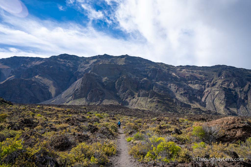
Sliding Sands Trail
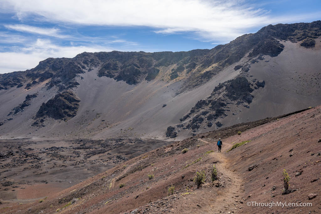
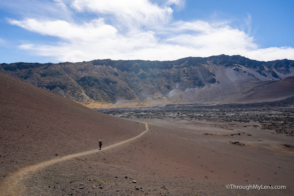
First up, the Sliding Sands Trail is the most popular in the summit district. This trail takes you from the visitor’s center down into the crater about 3,000 feet below you. This is a fantastic trail, and I have a full video on it. That being said, it is very tough. People often look at the mileage and think that the 6-8 miles round trip (depending on where you stop) is okay, but they misjudge that you have to descend and then ascend over 3,000 feet. This is very tough. Add to that the lack of shade on the trail when it is hot, and it is something to take seriously. You can go to an observation area about 1 mile into the trail and less than 1000 feet of elevation, so that is an option if you want to hike but don’t want to go all the way down into the trail. Lastly, you can hike through the crater on a long trail that requires either two cars for pick up and drop off or utilizing the park’s hitchhiking area. We did this in our full video on the trail, so you can learn more about it there if you are interested.
Pipiwai Trail

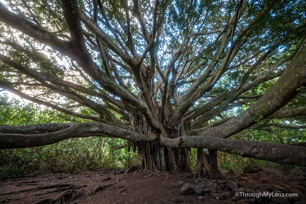
In the coastal portion, the Pipiwai Trail is the most popular. This or the seven sacred pools, but that doesn’t require any real comments from me as it is only a half mile. The Pipiwai trail is 4 miles round trip and has 900 feet of elevation. It is a relatively steep trail but it is not too bad if you take your time. The trail is amazing though with multiple waterfalls and an extensive bamboo forest. It is one of my favorite national park trails.
That it for my tips on visiting Haleakala National Park. I am trying to visit all of the national parks, so follow along if you want to see more content like this. Let me know if you have any questions on something I didn’t cover in the comments!